Fishing Spots - Fish Finder
- 4.5
- Rating
- 100.00K
- Installs
- Free
- Price
 Analysis by App-foxy
I approached Fishing Spots - Fish Finder as a practical companion for planning a fishing trip rather than as a simple map with a few pins. It is a sports app from Reworld Team that brings together fishing locations, an AI fish identifier, bite forecasts, parking information, and tackle maps. That combination makes it interesting because it tries to cover the awkward parts of a day outdoors: deciding where to go, working out what might be biting, identifying a catch, and finding the equipment or access information needed nearby.
My first impression is that the app is aimed at people who want more guidance than a standard map can provide. A normal map can show roads, lakes, and perhaps user-added places, but it usually leaves the fishing-specific decisions to you. Here, the focus is much narrower and more useful for anglers. The free download lowers the barrier to trying it, while optional purchases ranging from $0.99 to $49.99 per item mean that some deeper or expanded tools may involve spending. I would therefore treat it as a useful planning layer, not automatically as a complete replacement for local knowledge.
The app is available to an Everyone audience and runs on Android devices using Android 7.0 or newer. That broad compatibility is helpful if you use an older spare phone on the water, although actual comfort will still depend on the handset, screen, connection, and battery condition. It has reached over 100 thousand installs and holds a 4.5 average from 668 ratings, with 50 written reviews. Those figures suggest that the concept is connecting with a meaningful group of users, but they do not remove the need to test how well it fits your own fishing routine.
You May Also Like

 Pandora - Music & Podcasts
Pandora’s Music Is Easy to Start, but Harder to Recover
Pandora’s strength is its low-effort path from a seed to a station. Its weak spot is how much confidence it asks you to place in connection, setup, and quiet recovery.

 AccuWeather: Weather Radar
AccuWeather Review: A Quick, Clear Forecast for Everyday Decisions
For everyday plans, the best forecast is the one you can understand quickly. AccuWeather makes rain timing, radar, and local conditions easy to act on, with a few trade-offs.

 Hill Climb Racing
Why Hill Climb Racing Still Turns Crashes Into One More Run
A tiny car, a bumpy hill and one more upgrade: Hill Climb Racing keeps resurfacing because its simple chaos makes every near-miss feel personal.

 AliExpress - Shopping App
AliExpress Makes Global Shopping Feel Personal, but Shoppers Bear the Risk
AliExpress turns a global marketplace into a pocket-sized discovery engine. Its reach is useful, its shopping loop compelling, and its trade-offs easy to miss.

 Lords Mobile: Kingdom Wars
Lords Mobile Is a Kingdom-Building Routine, Not a Quick Match
A case-by-case verdict on the building, battles, device demands, and social commitments that make Lords Mobile rewarding for some players and exhausting for others.

 PDF Scanner app - TapScanner
TapScanner Makes Paperwork Easier to Capture, Check, and Share
TapScanner makes scanning with a phone feel less like a rescue operation and more like a dependable step in getting work done. Its capture tools are useful, though not flawless.
More From Our News Desk
View All News


How Fishing Spots - Fish Finder feels in real use
I find the app most useful when I treat it as a way to shape a fishing plan, not as a source that settles every decision. In this section, I’ll look at how its location and planning tools can fit into an ordinary outing, then consider the practical checks that help keep those tools in perspective.
Getting from an idea to a usable fishing plan
The most valuable way to use the app is before leaving home. Instead of opening it only after arriving at the water, I would begin by comparing possible areas, checking the fishing information available around each one, and looking at practical details such as parking. This changes the app from a last-minute locator into a planning tool. A promising body of water is much less attractive if access is inconvenient, while a less obvious spot may become worthwhile when the surrounding information is easier to work with.
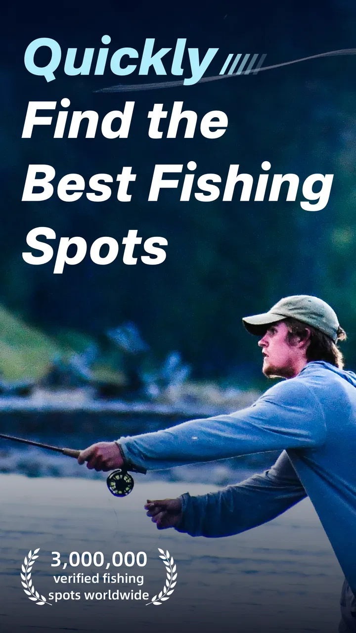
The three million-plus fishing spots are a major part of that appeal. A large collection is useful when I am travelling, exploring a new region, or simply tired of visiting the same familiar place. It also gives the app a chance to support different styles of fishing, from a quick evening session to a more deliberate day trip. Still, a large database is not the same thing as a guarantee that every location will suit my target species, current conditions, or access needs. I would use the spots as candidates, then apply common sense and local rules before committing to one.
The bite forecast is potentially the quickest way to decide whether a trip is worth making at a particular time. I see it as a planning signal rather than a promise. Forecast-style tools can help me compare days or locations, but they cannot account perfectly for every local change in water level, wind, bait activity, pressure, or angling pressure. The smart workflow is to use the forecast to narrow the choice, then bring the normal preparation I would carry even without an app.
Speed expectations and the cost of a busy screen
In ordinary use, I would expect the app to feel most responsive when I am browsing a focused area rather than trying to inspect everything at once. Map-based apps often have more work to do when a screen contains many location markers, supporting details, and map layers. Fishing Spots - Fish Finder is built around a very broad collection of places and several information categories, so the amount of content visible in a chosen region matters. A quiet local search should be easier on a phone than repeatedly moving across a large area and opening many entries.
That distinction is important for anyone judging performance. The app’s usefulness encourages exploration, but exploration can also create a heavier session. I would avoid tapping through every nearby spot before deciding what I actually need. A better approach is to begin with a broad search, shortlist a few realistic locations, and then inspect those in detail. This reduces visual clutter and makes it easier to remember why each location made the shortlist.
The AI fish identifier adds another kind of speed expectation. It is convenient when I want help recognizing a fish, but image-based identification should be treated as an aid, not an authority. A photo with poor lighting, an unusual angle, a wet lens, or a partially visible fish can make any automated result less dependable. For a quicker and more useful result, I would take a clear photo in daylight, include enough of the fish to show its shape and markings, and compare the suggestion with a trusted local guide or regulation source.
There is also a practical difference between fast interaction and fast decision-making. An app can open a map quickly while still leaving me with too many choices. Fishing Spots - Fish Finder works best when I use its tools in sequence: location first, access and parking next, forecast after that, and identification only when I have a catch to examine. That order keeps the experience focused and avoids turning a simple fishing plan into endless map browsing.
What happens during heavy-use moments
The demanding moments are likely to arrive when several tools are used together. Imagine a Saturday morning: I am moving around a map, opening fishing spots, checking a bite forecast, looking for parking, and then switching to the tackle map. That is a more intensive session than checking one location at home. The app’s value is precisely in combining these tasks, but the combination also makes a good device setup more important.
On a newer phone with a healthy battery, this kind of session should be easier to manage than on an older budget handset. I would expect map browsing and image analysis to feel more comfortable with a larger display and enough free storage for normal phone operation. I would not judge the app solely by a short glance at one screen; I would test it by performing the complete workflow I actually need before travelling.
For a fishing trip, I would also plan around connectivity instead of assuming that every location will offer a strong signal. The app’s features depend on information being available at the time I need it, and remote waterways are exactly where mobile service can become unreliable. Before leaving, I would review the chosen spots, note the parking details, and take screenshots or written notes of anything essential. That small habit protects the trip if the live map becomes slow or unavailable near the water.
Battery use deserves the same practical attention. A bright screen, map activity, location use, camera work, and network searching can all make a phone feel more demanding than a short indoor session. I would begin with a full charge, carry a power bank for longer outings, and avoid leaving the display active while waiting for a bite. The app may be perfectly usable without creating unusual drain, but outdoor navigation is a naturally heavier phone task than casual browsing.
Reliability, confidence, and sensible cross-checking
I like the breadth of the app, but I would not let a single forecast or spot listing make the final decision for me. Fishing conditions change quickly, and an apparently convenient location may have restrictions, difficult access, seasonal changes, or conditions that are not reflected in a general-purpose fishing database. The app can help me discover and organize possibilities; it should not replace checking local rules, signs, weather, water safety, and the advice of people who know the area.
The same caution applies to the AI fish identifier. Its best role is educational and practical: it can give me a starting point when I am unsure what I have caught. Its weaker role would be making a final decision about legal size, protected species, or whether a fish may be kept. Those questions require dependable local regulations and careful identification. I would use the tool to generate a possibility, then verify before acting.
Reliability also includes recovery when something goes wrong. If the app closes, loses a connection, or becomes inconvenient during a trip, I would want my plan to remain understandable without it. That is why I recommend recording the chosen location, parking point, and any important access notes before setting out. The app becomes much more dependable as part of a backup-friendly routine rather than as the only source of information on the day.
The version I reviewed is 1.0.93, which indicates that the product has an established release line rather than being presented as an untouched first build. Even so, version numbers alone cannot tell me how every phone will behave. Android hardware varies widely, and a map-heavy app may feel different on a small older screen than on a recent device. I would keep the app updated through the normal store process and judge performance after trying the exact functions I plan to use.
Device constraints that matter more outdoors
The minimum Android requirement of 7.0 makes the app accessible to many older devices, but compatibility is only the starting point. A phone can technically install an app and still be uncomfortable for outdoor use if the screen is dim, the battery is worn, or the device struggles with multitasking. A bright display matters in sunlight, while a responsive touch screen matters when I am wearing gloves or handling fishing gear.
Storage can become relevant if I take many fish photographs or keep other navigation and camera apps installed. I would leave some free space before a trip, especially if I use the AI identifier frequently. Keeping the camera lens clean is another small but important detail: a sharp, well-lit image gives an identification tool a much better chance than a rushed photograph taken with water droplets across the lens.
Older devices may also make the app feel less fluid when the map is busy. That does not necessarily make it unusable, but it changes how I would operate it. I would search in smaller areas, close unrelated apps, reduce unnecessary screen activity, and prepare the route before reaching the water. If my phone is already slow with ordinary maps, I would not choose a demanding fishing day as the first serious test.
iPhone users should note that this particular release information describes the Android version, so my comments about the minimum operating system apply to that platform. The important practical question for any user is the same: can the device show map information clearly, handle the camera workflow, and maintain enough battery and connectivity for the outing? Those constraints are more important than simply meeting an installation requirement.
Useful workflows beyond the obvious map search
One less obvious strength is how the tools can be chained into a decision rather than used separately. I would start by finding several spots within a reasonable travel distance, remove any that have awkward parking, and then compare the remaining options using the bite forecast. This is more efficient than choosing the first attractive pin and discovering later that reaching it is impractical.
A second useful workflow is to use the tackle map as a preparation check rather than an emergency shopping tool. If I know the area is unfamiliar, I can identify where equipment support may be available before leaving. That helps me decide what to pack and reduces the risk of assuming I can buy a missing item near the water. It also makes the app relevant to beginners who are still learning what a particular trip requires.
A third is to treat the AI identifier as a learning journal. After photographing a catch, I could record the suggested identity alongside the location and conditions in my own notes. Over time, that may help me recognize patterns in the places and conditions where I fish. I would still verify important identifications, but using the tool this way gives it value beyond a one-off answer.
There is a trade-off in this broad approach. An app that covers spots, forecasts, parking, tackle, and identification may be more convenient than switching among several specialized tools, but it may not go as deeply into every individual area as the best dedicated alternative. A specialist weather service may offer more detailed meteorological information, a local fishing forum may provide fresher personal reports, and an official map may be better for authoritative access boundaries. Fishing Spots - Fish Finder is strongest when I want one fishing-focused starting point, not when I expect one app to settle every question.
Who should use it, and who should skip it?
I think the app is a good match for casual anglers, travellers, beginners, and anyone who regularly fishes unfamiliar areas. It gives those users a structured way to move from “where could I go?” to “how practical is this place?” The combination of location discovery and planning details is especially useful for short trips where I do not want to spend more time researching than fishing.
It may also suit experienced anglers who already know how to judge conditions but want a faster way to organize options. The experienced user is less likely to accept a forecast or identification result without question, so the app becomes a convenient reference layer rather than a replacement for judgement. That is probably the healthiest way to use it.
I would be more cautious if I were a highly specialized angler who needs authoritative, species-specific regulations, deep local reporting, or highly detailed technical weather analysis. In that case, dedicated services and official sources may deserve priority. I would also skip relying on it as my only navigation or safety tool for remote trips. The app can support preparation, but it should not become an excuse to ignore offline planning, local restrictions, or basic outdoor safety.
The free price makes experimentation straightforward, but I would not unlock optional purchases automatically. I would first use the core experience, identify the exact part of my routine that feels limited, and then decide whether a purchase solves a real problem. The available in-app purchase range is wide enough that careful users should understand what they are paying for before confirming anything. For occasional fishing, the free experience may be sufficient; frequent users may find added value if expanded tools genuinely save research time.
My performance verdict after weighing the trade-offs
Fishing Spots - Fish Finder is most convincing as a fishing trip organizer. Its broad location coverage, bite-oriented planning, parking information, tackle maps, and AI identification give it more practical range than a basic spot finder. I especially like the possibility of preparing a shortlist before leaving, because that makes the app useful even when the phone is later used only briefly outdoors.
Its performance should be judged by the complete routine rather than by a single feature. The app is likely to feel easiest when I keep searches focused, prepare important information in advance, and avoid treating automated suggestions as final truth. Heavy map browsing, camera use, weak connectivity, and an older battery can all affect the experience, so sensible preparation matters as much as the software itself.
My recommendation is therefore positive but measured. I would install it if I wanted a free Android fishing companion for discovering places and organizing a day around them. I would pair it with official regulations, local knowledge, and a backup plan, especially for unfamiliar or remote water. For me, the strongest reason to try it is not one isolated feature; it is the way several fishing-specific tasks can be brought together without starting from a blank map.
Reworld Team has built something that can make the first stage of a fishing trip more deliberate and less frustrating. It will not remove uncertainty from fishing, and it should not pretend to replace experience, but it can help turn scattered research into a practical plan. If you approach it with that expectation, keep your device and battery limitations in mind, and verify important decisions independently, this is a useful tool for finding a better starting point and making your time on the water more organized.
FAQs for Fishing Spots - Fish Finder
01What features does Fishing Spots - Fish Finder offer?
Fishing Spots - Fish Finder offers a comprehensive range of features to enhance your fishing experience. It provides real-time maps showing popular fishing locations, weather updates, and water conditions. The app also includes a social platform for anglers to share catches and tips, plus a logbook to track personal fishing history.
02Is Fishing Spots - Fish Finder available for both Android and iOS?
Yes, Fishing Spots - Fish Finder is available for both Android and iOS devices. You can easily download it from the Google Play Store for Android or the Apple App Store for iOS. It ensures a seamless experience across platforms, allowing you to keep your data synced.
03Does Fishing Spots - Fish Finder require an internet connection?
While the app can function with limited offline capabilities, an internet connection is recommended to access real-time data, such as weather conditions, location updates, and community interactions. Offline, you can still access previously saved maps and your personal fishing log.
04Are there any subscription fees for using Fishing Spots - Fish Finder?
Fishing Spots - Fish Finder offers a free version with basic features, but for enhanced functionality, such as advanced mapping and exclusive tips, a premium subscription is available. The subscription fees vary, and users can choose from monthly or annual plans depending on their preferences.
05How user-friendly is Fishing Spots - Fish Finder for beginners?
Fishing Spots - Fish Finder is designed to be user-friendly, even for beginners. The interface is intuitive, with clear navigation and helpful tutorials. Whether you’re new to fishing apps or a seasoned angler, the app provides easy access to essential features and community support to help you get started.
Pros
- User-friendly interface for easy navigation.
- Comprehensive database of fishing locations.
- Real-time weather updates enhance planning.
- Offline mode available for remote fishing areas.
- Community-driven tips and reviews for each spot.
Cons
- Requires account creation for full features.
- Some features locked behind a paywall.
- Occasional inaccuracies in location data.
- Battery drain due to GPS usage.
- Limited customer support response times.

Fishing Spots - Fish Finder
Gallery